|
The Portland area features an extensive light rail
system consisting of four routes, with more than fifty-two miles of unduplicated
coverage. The system is collectively referred to as MAX, and is operated
by the agency commonly known as TriMet. The
original MAX route went between downtown Portland and the eastern suburb
of Gresham. This line started operation in 1986, fairly early in the
era of North American light rail renaissance. That route has since been expanded far to the west, and the
entire through service is named the Blue Line.
Newer tracks branch off on the Eastside north to Expo Center (Yellow
Line), and to Portland Airport (Red Line). In 2009 the Green
Line began operation, also on the Eastside, but to the south, to
Clackamas Town Center. With system expansion that year, a second route began
serving downtown, on a generally north-south alignment. All four lines cross the Willamette River on
the massive Steel Bridge.
In and near center city there is also a modern-day
version of a local streetcar line; it is under different ownership, and
it is treated in a separate series on this website.
There follow in this series a large number of pages from all over the
MAX system. A bit more about the organization of the material is
presented on the next page in the sequence.
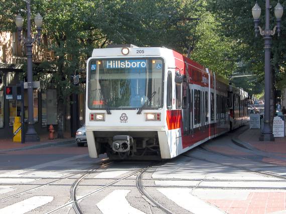
In this photo a westbound Blue Line train is passing along narrow,
tree-rich SW Morrison St. in downtown Portland.
It is just about to cross the
southbound Portland Streetcar track. The curving rails in the
foreground have served as leads to a center city turnaround area at various times during the
history of MAX. These tracks are not currently used by any regular
service. |