|
The main part of Boston's light rail
network is the Green Line, which consists of four different branches.
All go
under downtown in the Tremont St. Subway, America's oldest underground transit
route.
The heavy traffic and the multiple destinations result in headways
often only seconds apart during peak times, and in very crowded conditions at the old
stations.
Eastbound these routes end either underground at Government Center or North
Station, or at the venerable outdoor terminal at Lechmere, across the
Charles River in Cambridge.
West of center city, the subway continues under Boylston Street before
the first branch splits off for
Heath St. The three other lines emerge to the surface after Kenmore. The
longest route extends all the way out to
Riverside, in large part along former railroad right of way. Its
opening in 1959 was an early milestone in the rebirth of U.S. light
rail. The two other branches go to Boston College and to Cleveland
Circle.
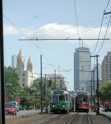
The view on this page, through a front window, shows
another car just ahead and an outbound train approaching. The subway portal and Kenmore station
are not far ahead. The Prudential Building
is in the background.
In addition to the Green Line, there is also a short trolley route
known as the Mattapan-Ashmont Line. It serves as an
extension to the Ashmont Branch of the Red Line subway, and has no
connections to the rest of the light rail system. And it still
uses those glorious old PCC streetcars. |