|
Chicago's heavy rail system is one of the oldest in the country,
although it has evolved greatly. There are eight lines,
each of which is identified by a color. During peak hours, all but the Yellow Line go to or through downtown.
Altogether the network is comprised of a bit over one hundred distinct route
miles.
This series is divided into four sections. First comes a number of
views in and of the Loop, or downtown. Then the pages venture north to
look at the Red Line to Howard, and the Brown, Purple and Yellow Lines.
Next comes the West Section: Blue Line to O'Hare, and also its other end
that goes west from downtown to Forest Park; Green Line to Harlem/Lake; and
Pink Line to 54th/Cermak. The last section goes south and
southwest, and presents scenes from the two South Side branches of the Green
Line, the Orange Line to Midway, and the Red Line, running mostly in the median of
an expressway to 95th/Dan Ryan.
Much of the Chicago system is outdoors, either elevated over
streets or alleys,
or on embankments, sometimes adjacent to regular rail lines, or running
ground-level through urban neighborhoods. There is also substantial mileage in the medians
of or alongside three of the city's expressways. And the Blue Line
and Red Line have long subway portions downtown and elsewhere.
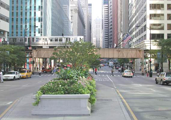
This photo is from a sunny September afternoon, and shows a Brown Line train
heading south along the Wells St. portion of the Loop. The scene is
distinctly Chicagoan -- heavy rail above the main streets of downtown.
The Loop is immensely, endlessly photogenic. And
the rail lines of the Chicago Transit Authority --
known as the CTA -- present countless opportunities for views
of the metropolis and of the rail system's infrastructure.
|