Boston's transportation network includes three heavy
rail subway routes. Each
operates its own
equipment; nothing is interchangeable, nor are there any track
connections between the lines.
The antecedents of
the Red, Blue and Orange Lines go back to the early decades of
the last
century. There has been much relocation, expansion, updating, and removal of
elevated trackage over the years.
The use of the color-coding dates to the mid-1960s;
Boston was one of the first systems in the country to use this
identification method.
The lines are fully in subway under downtown, but have outdoor sections
elsewhere, as well as other, sometimes substantial, underground portions. Also under downtown is the main light rail route, the
Green Line. Taken
together, the four routes form something of a jagged crosshatch under
the irregular street pattern of center city. There are transfer
points in each case where lines intersect.
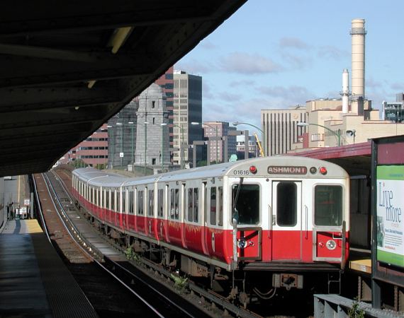
These pages -- far too few to do any kind of real justice to the system --
present some views of the system in Red, Blue, and Orange
Line order. The scene above is along the Red Line at the
elevated Charles/MGH station. Longfellow Bridge and some of
the buildings of Cambridge are in the background. |