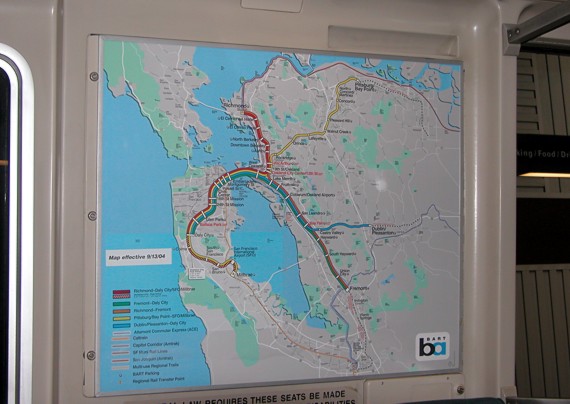
BART maps, prominently displayed in all cars and stations,
color-code the five lines. Despite this association,
the actual routes are identified by destination on station reader
boards and announcements, and not by the map color.
The map gives a fairly accurate geographic perspective of BART's
coverage area. East Bay terminals clockwise are Richmond to the
north of Oakland,
Pittsburg/Bay Point to the northeast, Dublin/Pleasanton to the
southeast, and Fremont, generally south. Total system length
is about 104 unduplicated miles.
Dotted lines from three of the East Bay
locations show generalized routes of proposed system expansion
projects.
The brighter shade of blue for the water in the southwest section of the map is
evidence of a pasting over, necessitated by revised service patterns
implemented to San Francisco Airport (SFO) and Millbrae.
Routings in that area have been changed at least twice since this 2004 view.
The current line between Pittsburg/Bay Point and San Francisco
Airport, at approximately sixty miles, likely the longest urban transit run
in the country. |